The Shardlow Heritage Centre offers guided walks
for groups by prior arrangement, and has on sale a 'Village Trail' leaflet
(price 25 pence) which guides the walker round the port area of the village.
(see our Home Page ) On this web page, we
give you an insight into older parts of the village along the main London
Road, and some further details within the port area. References to the
1882 map are those on our page 1882 Map of Shardlow
, the individual frames being 'west', 'west-central', 'east-central', and
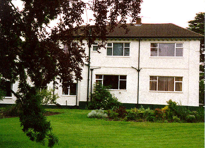
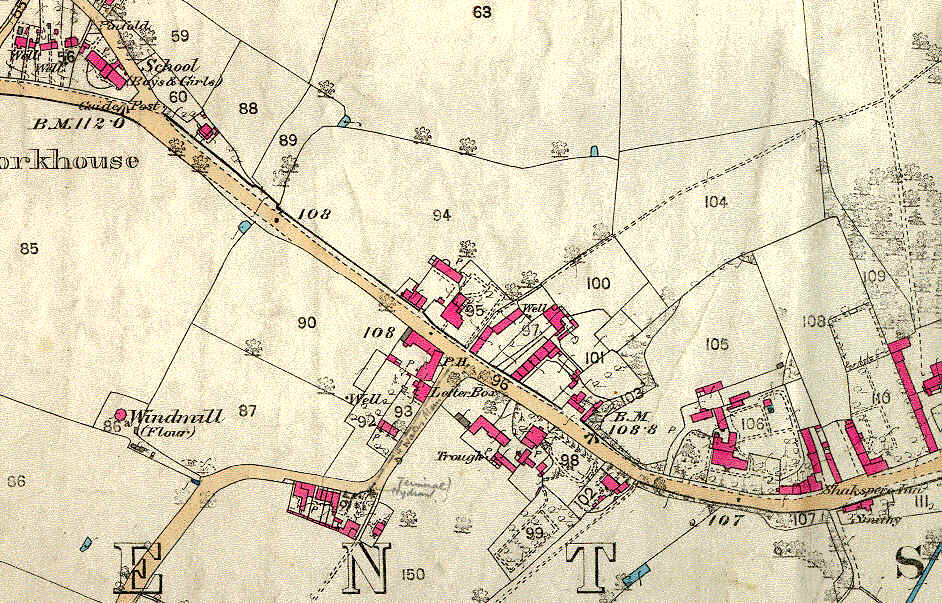
'east'. Approaching from Derby, Moor Farm is at the entrance to the village
on the left (just off the edge of the 1882
Map west ). On the right is the Grove which was originally a farm occupied by the
Hardy family and from the 1890's the orphanage of
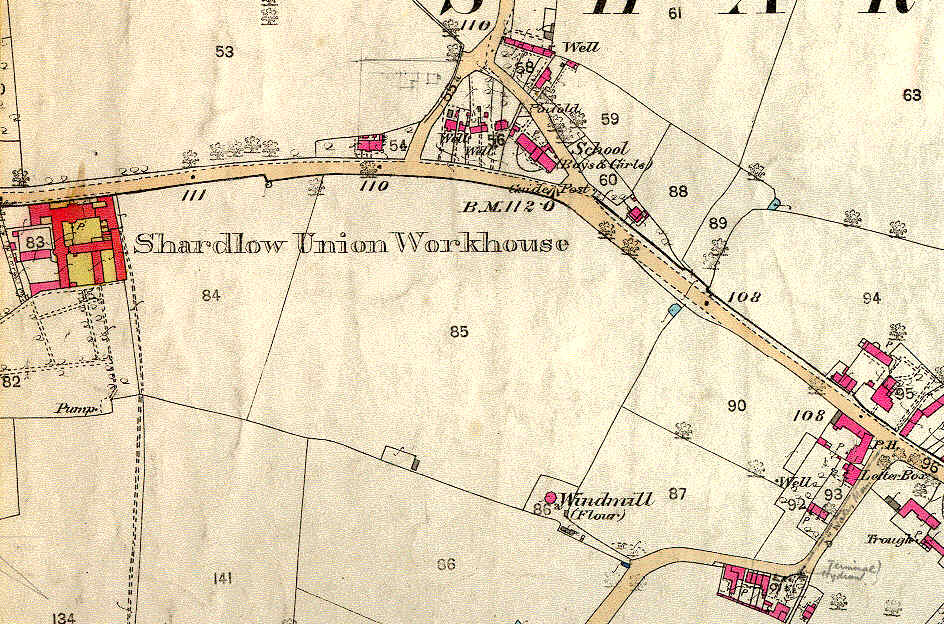
the Shardlow Union Workhouse. The main buildings of the workhouse have been replaced by
modern housing . The workhouse started life in 1811 as the House of Industry
for Shardlow, Draycott, Sawley and Worthington. By 1814, 24 other parishes
had joined and in 1832 the Shardlow Poor Law Union was formed - by 1857
there were 49 parishes in the Union. We have in our archives many interesting
plans and documents which give an insight into how it operated.
|
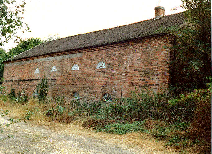
The photograph shows the building that was
the orphanage. .
|
 |
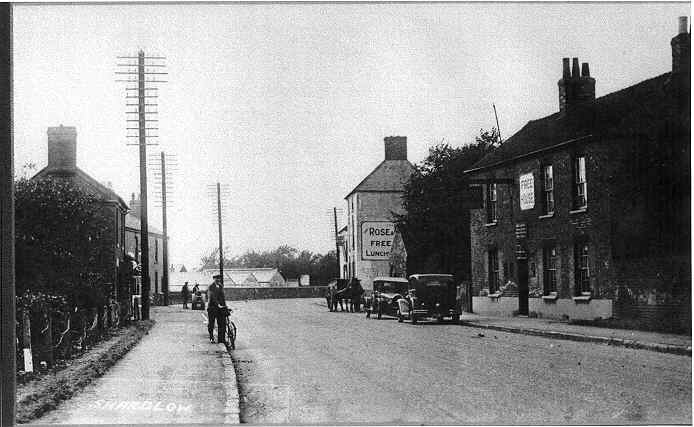
Shardlow used to have many small shops in people's
houses and the present post office is on the site of one of these, that
used to be run by the Ward family. Earlier still, a shop was run from a
shed adjoining the end of the terrace adjacent to the post office. This
may be the terrace marked '54' on the 1882
map - west .
|
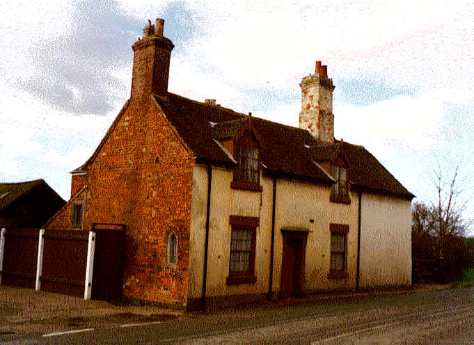
At the next road junction, where the road from Aston
on Trent comes in, is the Dog and Duck, a cruck framed building, tree ring
dated to 1480.
|
|
Here also are the Dower House ('plot' 95), a farm (97), and Shardlow House
(98) - the Cowlishaw family's oldest home in the village. The footpath
(the north sides of 'plots' 100, 104) marks the continuation of the old
road from Aston to Great Wilne and onwards over the river Derwent to Church
Wilne. 'Plot' numbers are from the 1882 Map
west-central image .
|
|
|
The Dower House
|
Shardlow House
|
|
On Aston Lane, near the bend, are cottages which
have an interesting history including a carpenter's workshop and a framework
knitters cottage - the results of a detailed investigation into these is
on display in the Heritage Centre.
|
 |
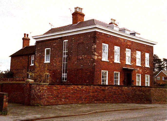
Back onto London Road, continuing past the Aston
Lane turn, on the 1882 map west-central
the building at 106 is Shardlow Manor. This was the home of the Burgin
family. Shardlow Manor was taken down and rebuilt in 1746-7 by John Chambers
of Wilne for Mr Alpheus Burgin at a cost of £43. The Burgin family
owned large portions of Shardlow including the Dog and Duck and part of
the land on which the church was built. Shardlow Manor was later used as
the rectory and is now a nursing home. |
 |
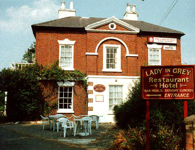
Next comes the Shakespeare Inn, a coaching inn.
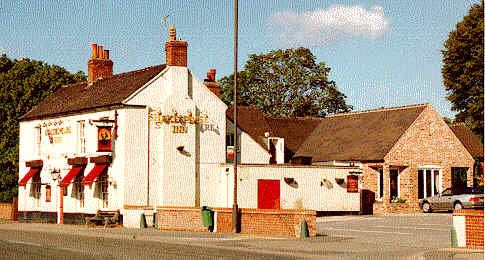
The Shakespeare Inn
Nearby used to stand the Rose and Crown of which a
traveller in 1789 tells us 'we put up at 4 o'clock at the Rose and Crown
just placed to my wishes though the hostler being drunk, and the women
of the house sulky were great drawbacks. But we had a good room, and our
horses sweet hay: our dinner of lamb chops was greedily eaten, and I now
(finding no bad effects) drink of their sweet ale'.
On the other side of the road where now there is a car sales business,
there used to stand a blacksmiths forge and cottages.
The Shakespeare Inn with the Rose and Crown behind
|
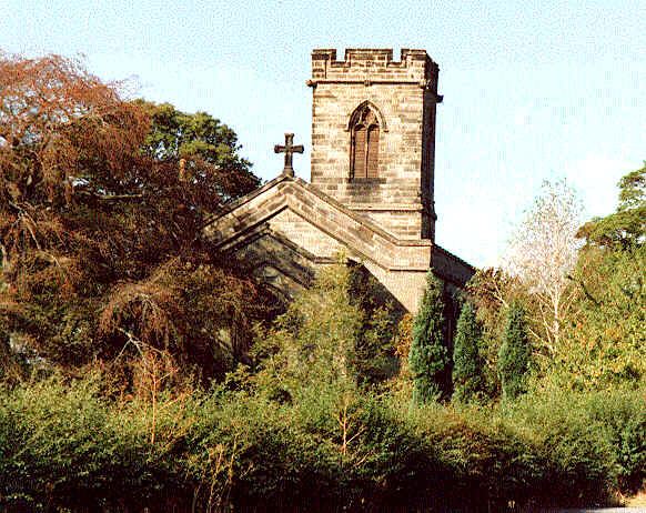
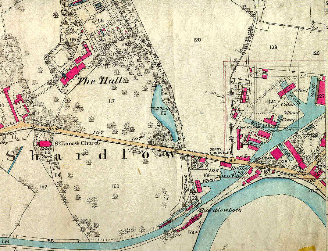
The church was built in 1838 on land donated by
the Sutton family of Shardlow Hall, which stands opposite. We are fortunate
in having much of the original correspondence about the building of the
church and its daily business for the first 100 years. A detailed survey of the monuments
in the church and the graveyard can be consulted at the Heritage Centre.
|
 |
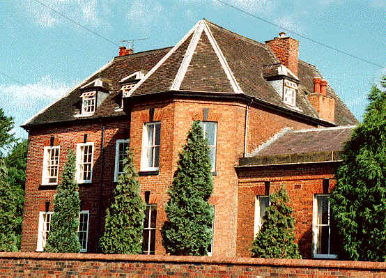
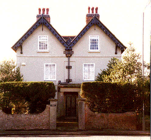
The original frontage of Shardlow Hall faced the
road from Aston Lane to Great Wilne (now the footpath), the original building
being 1684 with additions and a new frontage when the new turnpike (London
Road) was put through in the 18th century.
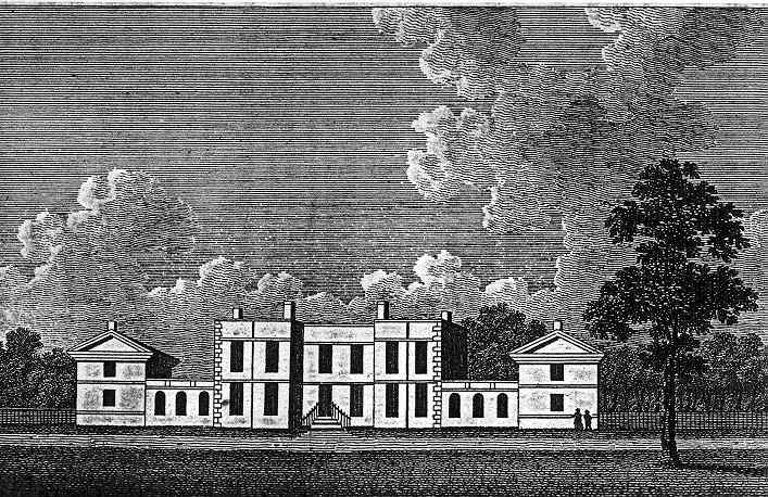
Shardlow Hall new frontage - early 1800's
London Road passes by green fields before reaching
the port area which prior to 1766 had only one building, which was a
river warehouse about 1/4 mile upriver. All this changed with the cutting
of the canal.
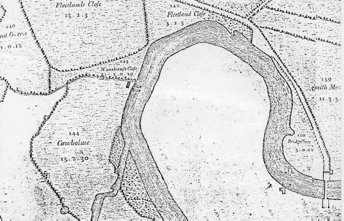 1766 map of port area immediately prior to the cutting of the canal, showing
the warehouse on the Cowholme (just below Warehouse Close); Fleetland Close
the site of the Clock Warehouse and the Shardlow Heritage Centre; and the
main road crossing the Trent over the Cavendish Bridge, built 1759.
1766 map of port area immediately prior to the cutting of the canal, showing
the warehouse on the Cowholme (just below Warehouse Close); Fleetland Close
the site of the Clock Warehouse and the Shardlow Heritage Centre; and the
main road crossing the Trent over the Cavendish Bridge, built 1759.
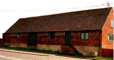
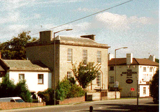
Having left the Hall and Church, the first surviving roadside building
on the right is the oldest canal warehouse in the village, in which the
Heritage Centre is situated. The 1882 Map east-central
shows another building to the west - this was 'the Limes', a building of
great significance being the Shardlow offices of the Trent and Mersey canal
company. It had been given a new victorian exterior, but locals say that
the interior had survived with original features. The building was demolished
as part of the scheme to restore the prized Clock Warehouse which straddles
the adjacent canal basin. In 1995, the site was purchased by Mansfield
Breweries and redeveloped as a family pub, complete with
a representation of an Upper Trent Barge in the canal arm under the
building, and providing accommodation for the Heritage Centre in the adjacent
warehouse.
|
The oldest canal warehouse in the village - the
salt warehouse which houses the Shardlow Heritage Centre
|
 |
The road continues over the canal (bridge 3) and immediately before
the Navigation Inn is a turning left into Wilne Lane, leading to Great
Wilne and thence to a footpath crossing the river Derwent to Church Wilne.
The section of Wilne Lane from the London Road to Great Wilne probably
did not exist before the enclosure of 1758, the old route being as previously
described from the Aston turn.
|
The building on the left as you turn into Wilne
Lane is Broughton House, the home of the Sutton family before they
bought the Hall in 1826.
|
|
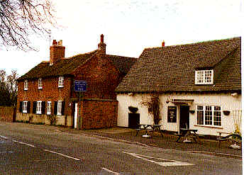
The Navigation Inn was also a property of the Sutton family, and is described
by Pastor Moritz in 1789 shortly after it was built. He was not too happy
about the company 'a wilder, coarser, type of man than those I met gathered
together in the kitchen of this inn I have never seen'.
Navigation Inn and Broughton House at the time that James Kerry was
licensee and before the road widening of 1936
|
Continuing along Wilne Lane, the next building on
the left was built by the Soresby family in the 1770s. They were
an important canal carrying company here from the time the canal was built.
|
|
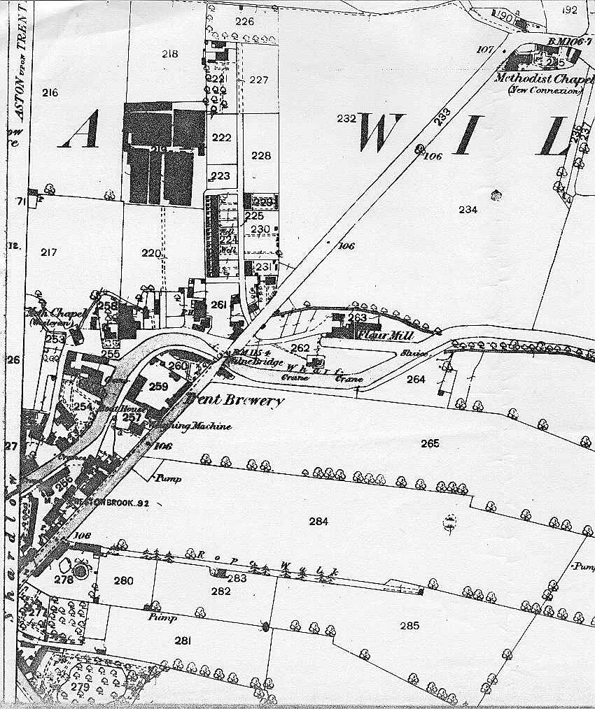
Now refer to the 1882 Map east . Note the
ropery building off to the right on the side of the field, run in its early
years by the Sutton family and from the 1870's by the Henshall family.
The Trent Brewery, erected about 1860 by Zachary Smith, was on the
site now occupied by modern houses just before the Wilne Lane canal bridge.
A public car park is opposite. From the canal bridge, the New Inn and Malt
Shovel are on the left.
|
The Ropewalk building
|
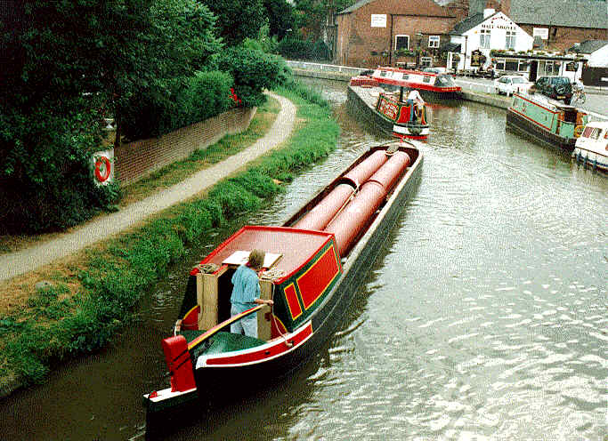
Narrowboats carrying iron pipes from Stanton to Devizes 1995
|
|
Leading off Wilne Lane to the right is Millfield,
where a large steam corn mill was operated from 1860 until it burnt down
in 1885. We are still searching for drawings or photos of this, but a granary
survives although reduced in height to create a 2 storey dwelling.
|
 |
|
The Methodist Chapel (now a dwelling) marks
the start of Great Wilne, the oldest part of the parish, where Roman remains
have been found. Here are a fine buttressed barn, Tudor cottage and interesting
farmhouses and buildings.
|
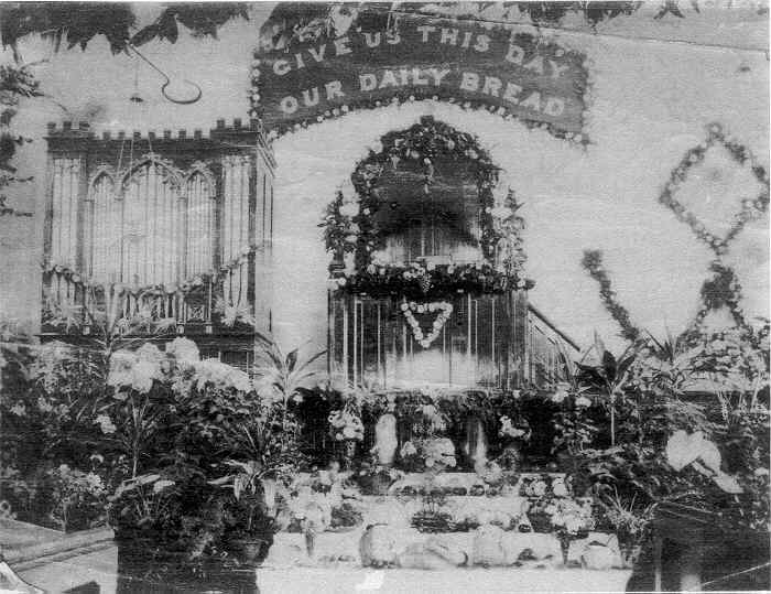
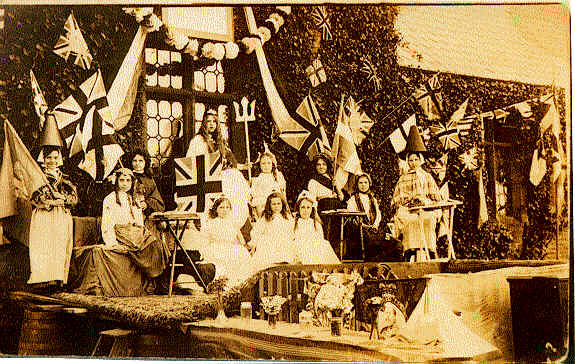
A harvest festival in the Methodist Chapel, Great Wilne 1892
|
It is thought that at Great Wilne another road went off to the right and
was then the main route to a crossing of the River Trent thought to be
a little upstream of Derwentmouth. There were Iron Age and Bronze Age settlements
on this route near to the River Trent, which have been investigated by
the Trent Peak Archaeological Trust, and ancient bridge remains have been
found in the gravel quarries on the other side of the Trent. The
18th century turnpike road crossing at Wilden Ferry, now Cavendish Bridge,
is the crossing in use today.
|
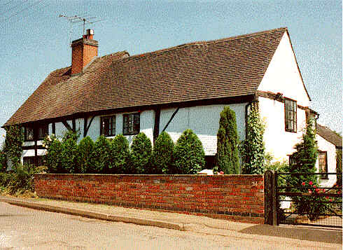
Tudor Cottage at Great Wilne
|
 |
After Great Wilne the road comes to an end, although it used to continue
straight ahead to a crossing of the river Derwent at Wilne Mills, variously
used for corn milling, lead rolling and slitting, and cotton milling. From
the road end, the present footpath to the right leads to the modern footbridge
and Church Wilne.
|
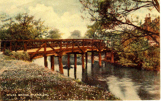
Wilne Toll Bridge in the 1920's
|
 |
There are alternative footpaths from Great Wilne, including one to Derwentmouth
Lock on the canal, from where one can walk the towpath back into the village
- or continue downstream along the River Trent to Sawley.
|
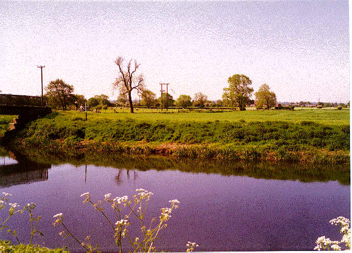
New footbridge over River Derwent, looking back
to Great Wilne
|
 |
|